Can you help save a Green Lane - Bream (Cross) Lane?
Riders please help us by filling the User Evidence Forms linked below, if you have been a user prior to 2006. Closing date for submissions is 17th March.

Talk to our RoW officer Kelvin if you need more info. View the location with Google Maps
There is a Gallery with images and map further down the page.
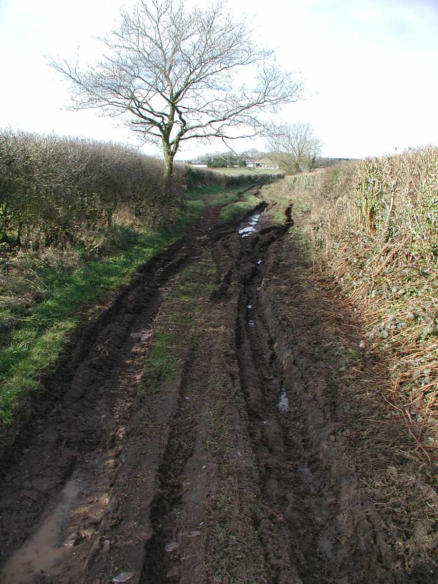
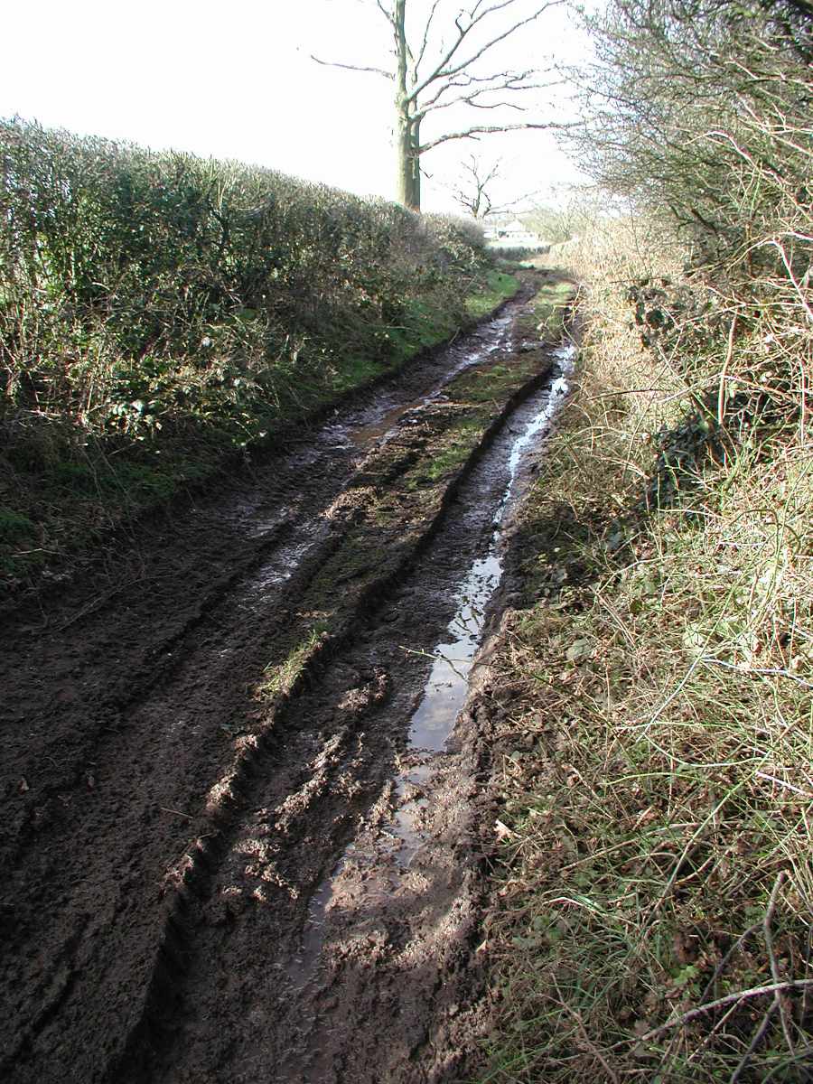
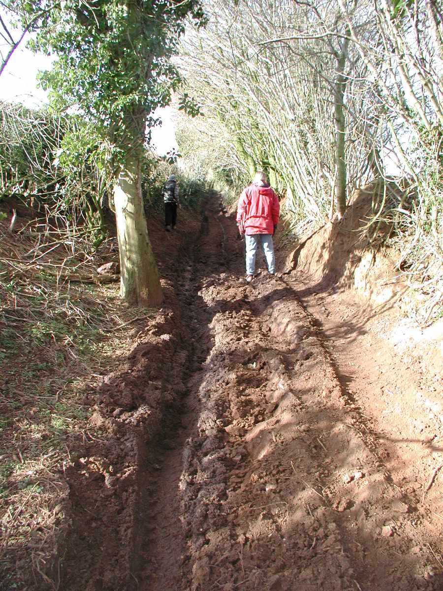
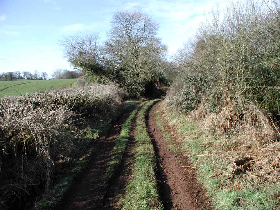
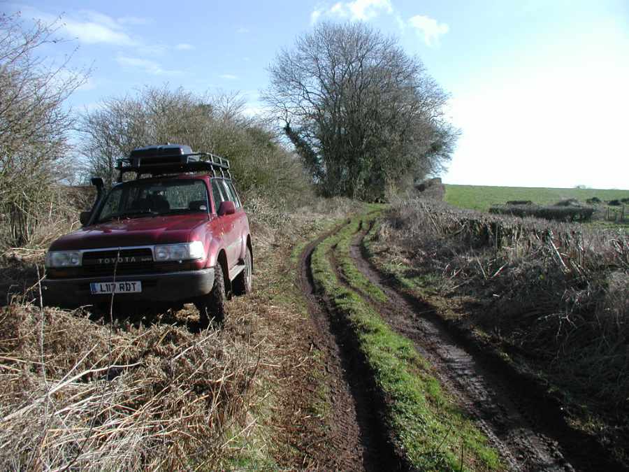
The Lane
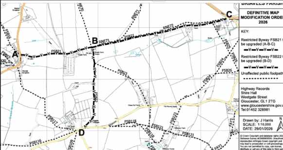
There is a definitive map modification order claim being processed by Glos County Council for two adjoining tracks in East Glos near the village of Bream. The claim is to reinstate them as Byways Open to All Traffic (BOAT) that will allow motorcycles and others to use them. It is currently recorded as a Restricted Byway due to preliminary NERC act interpretation by GCC back in 2006. The track is known as Bream Lane and by some as the Chicken Run due to the nearby chicken farm at Roads Farm. The claim is dated Nov 2005 but if it can be shown it was used mainly by motorised vehicles then one of the NERC act exemptions will kick in and save the lane for us to use on motorcycles.
A few people in the area have submitted evidence of motorised use but more is need to hopefully ensure it's sufficient. If you have used the lane prior to May 2006 on a motorcycle or in a vehicle your evidence could be what sways the decision! Below are the docs you need to complete and guidance docs on submitting evidence.
Evidence Docs and Help sheet
- Public Right of Way User Evidence Statement - Information Sheet (Word Format)
- Public Right of Way User Evidence - Declaration (Word Format)
- Public Right of Way User Evidence Statement (Word Format)
- DMMO - Information Sheet (PDF Format)
The tracks are just south of the Orepool Inn (the start point for the Wyegate LDT), South of Sling and West of Bream on the edge of the Forest of Dean
You will need to return the declaration page and the questionnaire to Glos CC at modificationorders@gloucestershire.gov.uk quoting Reference 573/11/209(15)&(11). GCC say info such as age and address as on the questionnaire are important when analysing the claimed use, so make sure you fill in the forms correctly and completely. They are not onerous and your effort may help save a green lane.
Evidence of motorised use is needed by as many people as possible preceding 2006. Doesn't matter how far back the evidence goes although the 5 years preceding May 2006 is ideal.
The Wyegate LDT used the track in at least 1989 , 1992, 1993 , 1995, 1996, 2003, 2004, 2005 and 2006 (Click the linked years to see if you were an entry or helping that year. The missing years in between could also have used the lane but we're still looking for the route documents.)
This claim may stand a better chance of succeeding than other previous similar claims in the area as there are fewer local properties and therefore possibly less objections or claims of alternate main use.
Closing date is 17th March. Glos Highways did say that written email replies as evidence are acceptable although its worth reading the questions in the evidence form to see what things they want to know about and avoid them having to come back for clarification.
Check your maps and memory banks and get your evidence in! Any queries please contact Kelvin Varney the WGDFMCC Rights of Way bod on Husqavarney@gmail.com
Images and Map
Click to step through the shots.